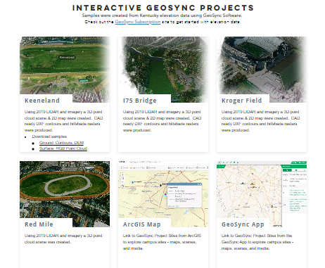
Check out our Interactive Projects Gallery
Includes an ArcGIS Integration Example
- id a feature and click “More Info” next to the url attribute to launch a GeoSync Project
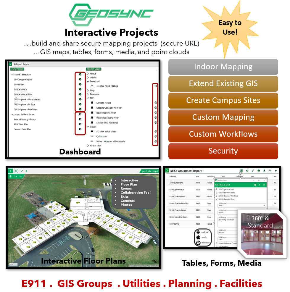
Publish and share secure GIS projects containing an interactive dashboard with maps, 3d scenes, tables, forms, and media. Adds value to your existing mapping or GIS operation by making it easy to share site or area specific data sets. Quickly deploy field or office workflows by setting up project specific maps and forms. Projects, maps, scenes, tables, forms, and media have secure web URLs for easy deployment as stand alone applications or easy integration with any existing geospatial application.
Includes an ArcGIS Integration Example